Are Late, Wet Hurricanes Becoming a Trend?
By Max Dorfman, Research Writer, Insurance Information Institute
10/29/2020
Hurricane Zeta became the 11th named storm and 6th hurricane to hit the United States yesterday, as the extremely active 2020 Atlantic hurricane season continues. Zeta struck just one day before the eighth anniversary of Superstorm Sandy.
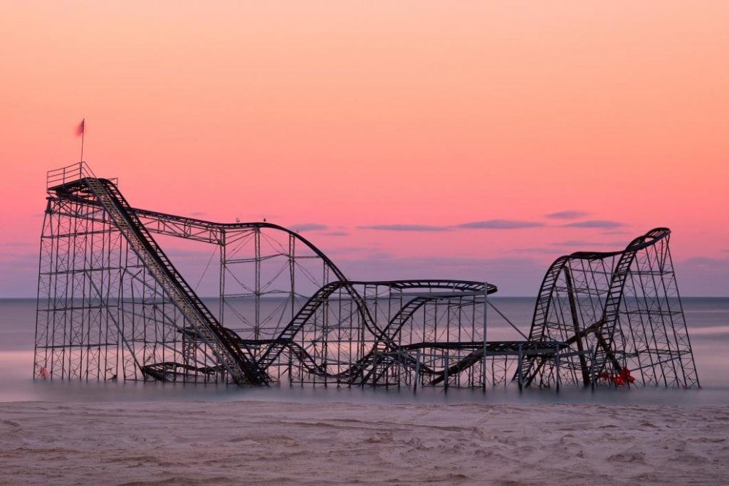
Sandy was the deadliest and most destructive hurricane of the 2012 Atlantic season, causing $70 billion in economic damages and resulting in over 70 fatalities when it made landfall in New Jersey. It surprised an under-prepared New Jersey and New York City when it arrived. Sandy was no longer a hurricane when it made landfall, having undergone transition into an extra-tropical (e.g., non-tropical) low pressure area earlier that day. Although it was no longer a hurricane upon its arrival, it was still immensely damaging due especially to its large size, as well as its interaction with a strong storm system moving east.
There is some history of late-season hurricanes, but Colorado State University climate scientist and Triple-I non-resident scholar Dr. Phil Klotzbach says it would be an overstatement to call this a trend.
“We haven’t really seen a trend in late-season hurricane activity,” Klotzbach said. “A lot of what drives late-season hurricane activity is the phase of El Niño or La Niña. If you have a La Niña, like we have this year, which is colder water in the eastern and central tropical Pacific, that tends to reduce the vertical wind shear that typically tears apart hurricanes. Reduced wind shear tends to keep the hurricane season going longer.”
Klotzbach noted that 2012 was neither an El Niño nor La Niña year.
What made Sandy different?
Hurricane Sandy was a massive aberration.
“Normally, when storms spin up in the Caribbean and move northeast, they continue moving northeast into the North Atlantic and do not significantly impact land,” Klotzbach said. “Unfortunately, with Sandy it started moving northwest.” Indeed, Sandy managed to wreak havoc across the Northeast and other parts of the country, including dumping as much as 36 inches of snow in West Virginia.
“There was a big high-pressure area over the Atlantic Provinces of Canada that built to the north of Sandy and drove the storm to the northwest,” Klotzbach explained. “The sustained winds were strong, maxing out around 80 mph, but the real problem with Sandy was its tremendous size.”
Given the large size of Sandy, it drove a huge storm surge that spanned from New Jersey to Connecticut including New York City.
“The storm surge from Sandy was incredible,” Klotzbach said. “The surge also coincided with astronomical high tide, which exacerbated the inland penetration of water from the coast. For example, the storm tide at the Battery on the southern tip of Manhattan exceeded 14 feet.”
What we can do
The public needs to be more informed about the dangers of these kinds of storms. Even though Sandy wasn’t technically a hurricane when it made landfall in New Jersey, Klotzbach believes the transition of the storm from hurricane to extra-tropical may have been confusing for people who didn’t understand that the storm wasn’t less of a threat after its classification was altered.
“Just because the storm was changing in structure doesn’t mean it wasn’t a significant threat,” Klotzbach said. “It had just about the same maximum winds as when it was a hurricane. People also looked at the maximum wind and saw that it was 80mph and didn’t think it was that much of a problem. But it was an enormous storm, so the surge was much bigger than what you’d expect from an average category 1 hurricane. From that perspective, there were challenges with conveying the magnitude of the threat.”
Indeed, Klotzbach gives a dire warning about the risks associated with not taking these storms seriously.
“A lot of it is in the messaging when these storms are going from tropical to extra-tropical,” he said. “We need to convey how these threats are changing and that just because a system is becoming extra-tropical doesn’t mean that the threat has gone away. We need to get more social science integrated into meteorology to better convey these results to the general public.”


